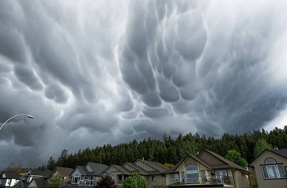
Strangely shaped clouds that appeared during stormy weather in Kamloops this week are turning heads.
The clouds, known as mammatus clouds, were spotted Wednesday evening, around the same time as a thunder and lightning moved through the region.
ALSO READ:
While their shape draws eyes, Environment Canada meteorologist Armel Castellan told Black Press Media that they are often associated with severe storms all over the world.
The shapes are caused by the instability and convection of violent vertical movements happening above the cloud, Castellan said.
sa¹úŒÊŽ«ÃœTheysa¹úŒÊŽ«Ãœre really indicative of downdrafts in the cloud,sa¹úŒÊŽ«Ãœ he explained.
The clouds got their name based off the Latin word sa¹úŒÊŽ«Ãœmamma,sa¹úŒÊŽ«Ãœ which means udder or breast.
They can be as large as three kilometres wide or as small as 1.5 kilometres and usually appear in the sky just before or after heavy downpour or strong winds.
sa¹úŒÊŽ«ÃœTheysa¹úŒÊŽ«Ãœre a pretty magical little interlude in a severe thunderstorm element, which is fast moving - so itsa¹úŒÊŽ«Ãœs like a little pause moment,sa¹úŒÊŽ«Ãœ Castellan said.
Took this last night
sa¹úŒÊŽ«Ãœ Jeff the Giant (@SoxofWhite)
ashley.wadhwani@bpdigital.ca
Like us on and follow us on .


