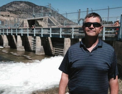
Okanagan Lake is sa���ʴ�ý�rising and rising fairly fastsa���ʴ�ý� in the words of the Okanagan Dam water release manager Shaun Reimer.
Reimer, the section head, of public safety and protection for the Ministry of Environment branch in Penticton, said the wave of record-high temperatures this past week has over-stimulated the spring snowpack melt.
sa���ʴ�ý�It is kind of normal-ish to see the lake rising about three centimetres a day this time of year, but with the way the weather has been and the possibility of rain this weekend, we are looking at it rising more rapidly than that,sa���ʴ�ý� Reimer said.
He said Okanagan Lake remains 85 centimetres short of the 342.48 cm full pool.
Reimer said a gradual process would see the snowpack melting first at the lower, then mid-elevation and then higher-elevation levels, which is contingent on below-freezing level temperatures still occurring at those mid and higher elevations.
That process was further enabled by cooler-than-normal temperatures throughout April.
sa���ʴ�ý�When you were driving around, you could clearly still see the snow level at higher levels,sa���ʴ�ý� he said.
But that all changed quickly with the combination of temperatures rising above 25C and staying above freezing at night, he says, causing the snowpack to melt simultaneously at all three levels, as the tributaries released unusually high levels of water into Okanagan Lake and Okanagan River ahead of schedule.
sa���ʴ�ý�Normally we hit our maximum targets towards the end of June, but the abrupt extreme weather changes can impact that,sa���ʴ�ý� Reimer said.
Beyond the rain, he is hoping in the short term to see the weather cool off, and sub-freezing temperatures return to the higher elevation mark.
sa���ʴ�ý�So we are expecting rain this weekend so that will not be welcome at allsa���ʴ�ý�but with thunderstorms, it can be localized in terms of intensity in a given area so not sure how it will impact us until it happens,sa���ʴ�ý� Reimer said.
He noted a legacy of past wildfires in the watershed over the past 20 years also leaves behind a potential for more silt turbidity in the tributariessa���ʴ�ý� freshet outflows.
sa���ʴ�ý�Right now I am more nervous about the tributaries feeding into the Okanagan River. I am feeling good in the short-term for Okanagan Lake, and wesa���ʴ�ý�ll see what kind of weather issues arise,sa���ʴ�ý� he said.
sa���ʴ�ý�I know the last couple of Junes have been very difficult for us but June is typically our wet month. So when we have above normal precipitation levels in what is already a wet month for us, that is where we get into problems.sa���ʴ�ý�
READ MORE: Heavy rain coming to the Okanagan, more flooding possible
READ MORE: Flooding causes extensive damage at Parker Cove on Westside
Like us on and follow us on .


